OsmAnd 3.0 (Android)

OsmAnd has reached the 3.0 milestone! The version with a completely new 'Travel' menu, updates to GPX import and a new way of starting subscriptions is now available.
Travel menu and WikiVoyage
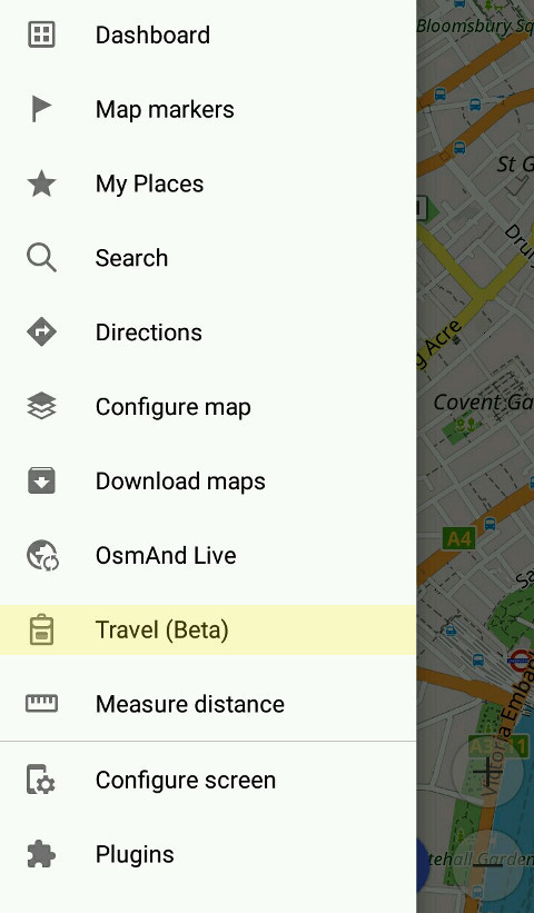
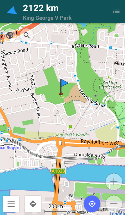
We aim at making OsmAnd not just your navigator but also your all-around travel companion. This is why we added the 'Travel' section to the menu. It offers you a handy travel guide to almost any big city – download it to use offline later. All the data is provided by WikiVoyage – an open travel guide anyone can edit. Its concept is similar to OpenStreetMap, as all the information is added by volunteers. The guide offers extensive information about cities, countries, and specific travel topics. You can easily find the one that matches your destination.
 |  |
|---|
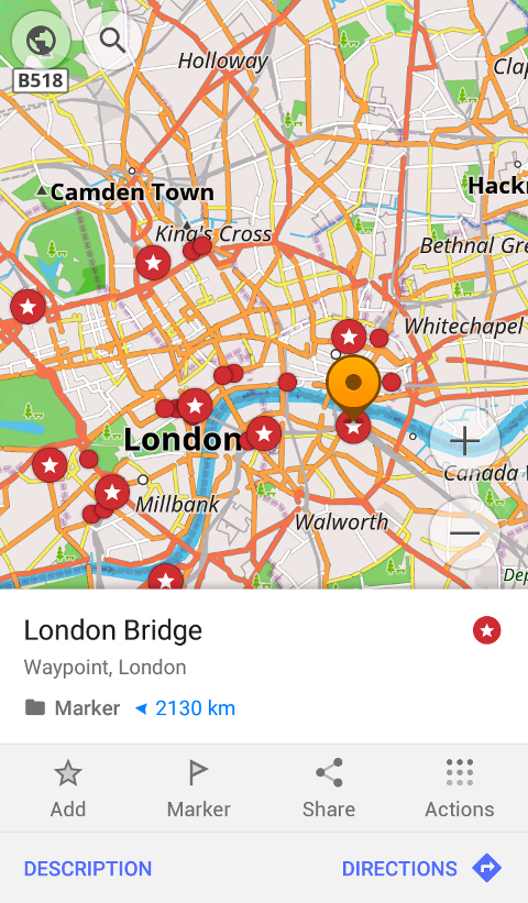
To find the right guide for your city, open the 'Travel' menu and enter the city name into search, then open the article and press 'Bookmark' to use it later. You'll also see the information conveniently arranged by topics ('Get in', 'Talk', 'Eat', etc.). Next to that information, you'll find a set of points that cover all kinds of tourist needs: from landmarks to nearby supermarkets. You can share those points as GPX track or view their list in 'Points' menu.
 |  |
|---|
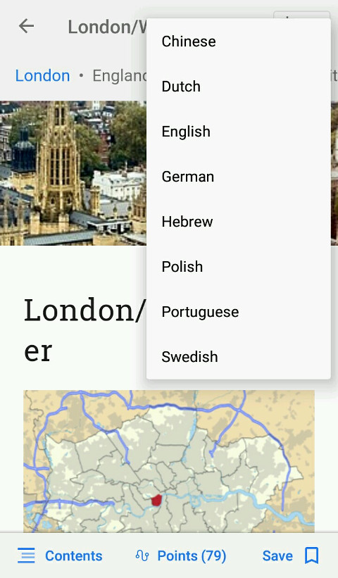
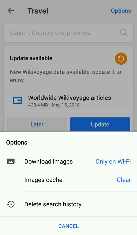
By default, the articles will be displayed in the language of the application, but if you'd like, you can switch them using the translation button in the upper-right corner of the article. Adjust the feature to your needs: press 'Options' to enable or disable images, clear image cache, if needed, or delete search history. 'Travel' is an open beta now. Later, the feature will be available in OsmAnd Live subscription.
 |  |
|---|
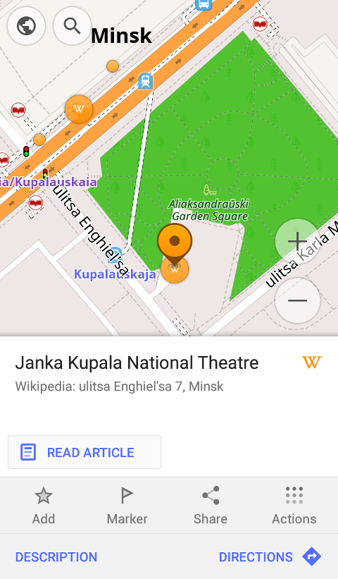
Wikipedia
Wikipedia articles have been available in OsmAnd for a long time. In the new version, we updated the look of the pages for better user experience, added active links to the articles and also enabled images. As always, all you have to do is download the Wiki file and enable the feature in Configure map > POI > Wikipedia.
 |  |
|---|
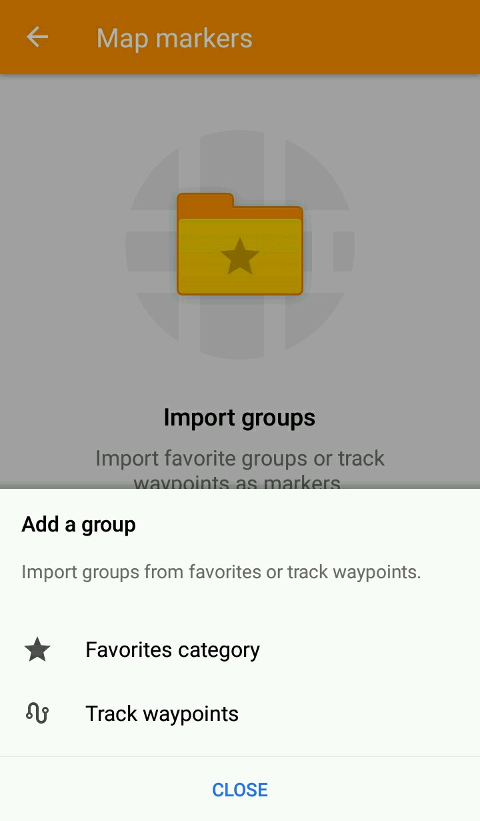
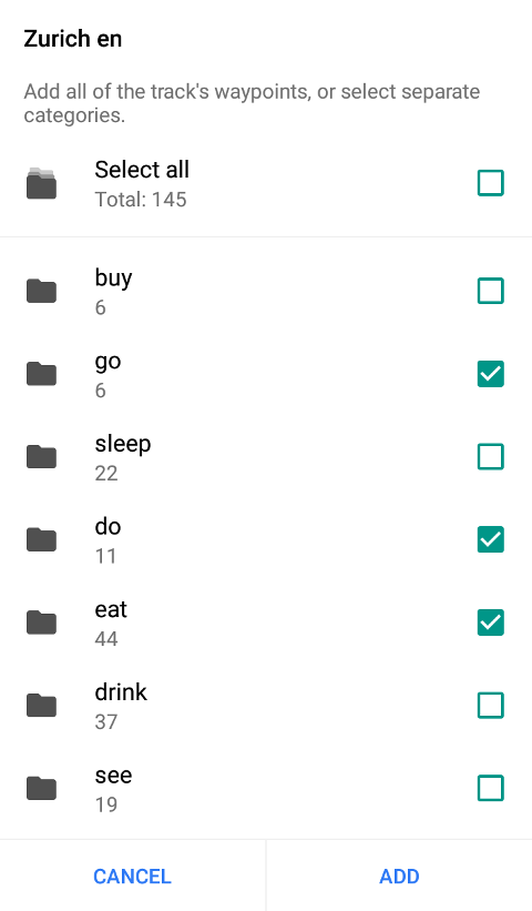
Map markers import
Map marker import has been improved in OsmAnd 3.0. If you have a GPX file with different groups of waypoints, you can pick which you need and import them as map markers. This feature can be helpful for travelers.
 |  |
|---|
To try it, download a GPX file, then go to Map markers > Groups > Import. Pick the GPX file. If it has sub-categories stored in folders, you'll be able to pick which to import. Select the groups you'd like to add.
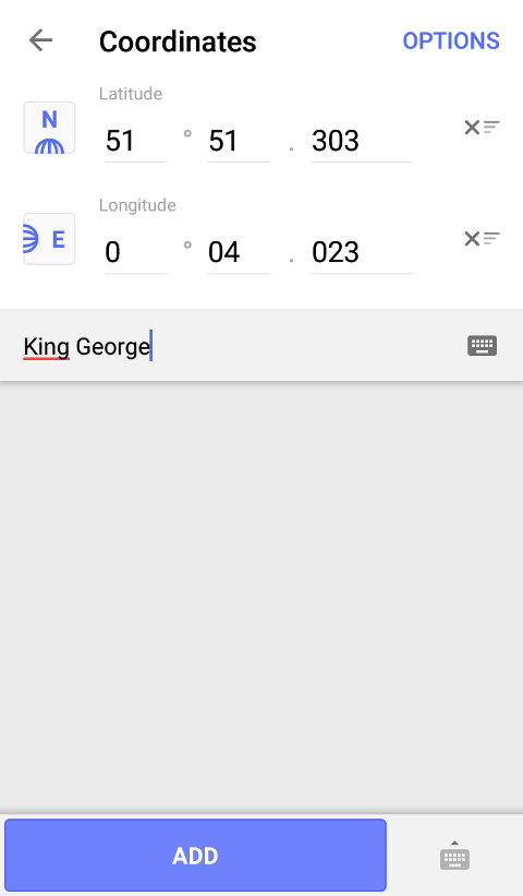
Map markers coordinate input improved
The menu allowing you to add map markers using their coordinates has been reworked, as well. You can now conveniently change the pole for your coordinates and name your points.
 |  |
|---|
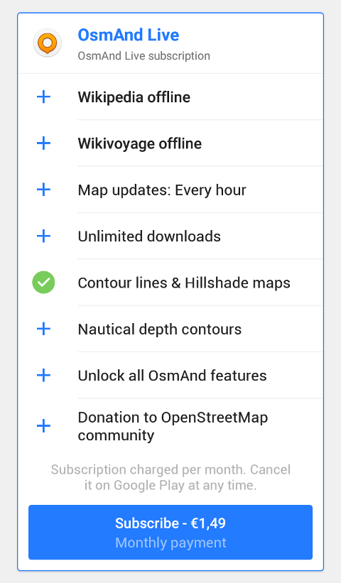
Update of OsmAnd Live subscription
The system of OsmAnd purchases has become even more convenient. From now on, OsmAnd Live subscription unlocks all paid features for the period of 1 month. This includes contour lines, sea depths map, unlimited downloads, Wikipedia and Wikivoyage articles offline. You can either start a subscription or get OsmAnd Unlimited with unlimited map downloads, Wikipedia and Wikivoyage. Both features are now available in Travel menu of the app.
 |  |
|---|
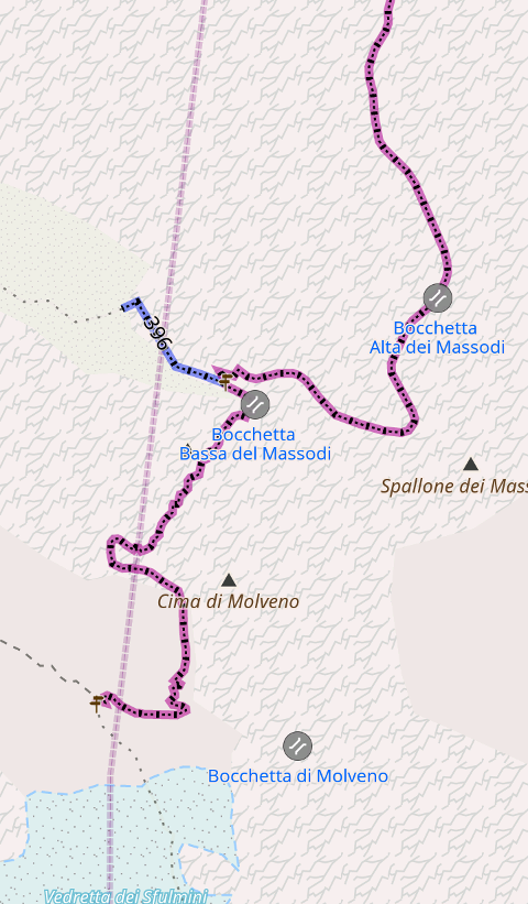
We also added some UI updates, including the one for opening GPX tracks. Now, the waypoints are shown in groups for your convenience. Also, OsmAnd now has a new feature for tourists and mountain climbers: the 'via ferrata' climbing routes are now shown on the map by default.
 |  |
|---|
And remember that only together we can achieve the best results! New features are coming SOON!
Follow OsmAnd on Facebook, TikTok, X (Twitter), Reddit, and Instagram!
Join us at our groups of Telegram (OsmAnd News channel), (EN), (IT), (FR), (DE), (UA), (ES), (BR-PT), (PL), (AR), (TR).

