Plugins
Overview
Plugins significantly extend the functionality of OsmAnd. Each is designed to address a specific task or use case, such as recording a trip, accessing Wikipedia articles offline, visualizing terrain data, or providing a street-level view.
Plugins can be internal, activated in the OsmAnd application, or external, separately installed programs. Third-party plugins work through the OsmAnd API and can access OsmAnd data.
Configure Plugin
To access a plugin's functionality, it must first be enabled, and some plugins require a purchase before use. Then, in some cases, a specific map layer must be activated, or a user profile must be configured.
Enable / Disable
- Android
- iOS
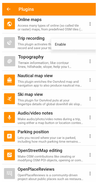
Go to: Menu → Plugins → ︙ → Enable
Go to: Menu → Plugins → ✓
Purchase
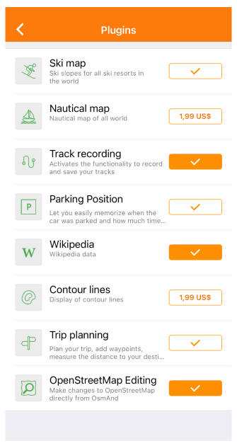
Most plugins are available for free, only the plugins in the list below require the purchase of an OsmAnd+ or OsmAnd Pro license to use:
- Topography
- 3D Relief (feature of the Topography plugin)
- Wikipedia
- Nautical map view
- Weather
Detailed information about the application purchase can be found in the Purchase section.
Plugin Features
OsmAnd Plugins may augment these Feature groups: Layers, Widgets, Context Menu actions, Drawer actions, Map Style, Map Source, Profile.
🤖 - only for Android version of OsmAnd.
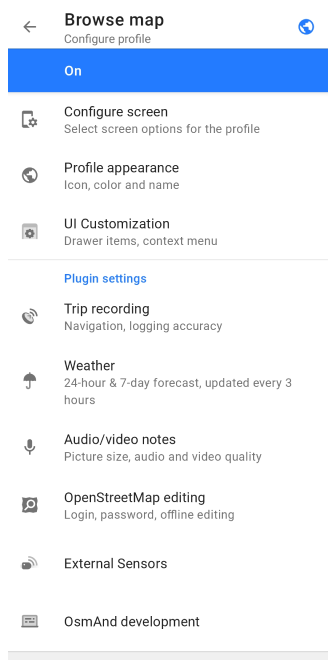
Plugin Settings
Only the OsmAnd development plugin and the OSM editing plugin change settings for all profiles. The remaining plugins are configured for each profile separately.
Most plugins provide specific profile or global settings, which can be accessed via:
- Main Menu → Plugins → Plugin name → Settings (⚙ for ios) or
- Main Menu → Settings → Profile → Plugin settings.
- Android
- iOS
The following plugins provide their own settings:
🤖 - only for Android version of OsmAnd.
| Plugin name | Settings |
|---|---|
| Trip recording | Сonfigure the trip recording operation modes |
| Weather | Configure measurement units for displaying weather events |
| Audio/video notes 🤖 | Select video format, how long to store, etc. |
| OpenStreetMap editing | Specify user login |
| External Sensors 🤖 | Connect to external device Settings |
| Accessibility 🤖 | Settings allow you to use Accessibility Android features inside OsmAnd. |
| OsmAnd development | Plugin settings allow you to enable special features for developers or experienced users |
| OsmAnd Tracker 🤖 | All settings are configurable in a separate app |
| AIS vessel tracker | Plugin settings allow you to enable special settings |
Plugin Actions
Reset plugin settings to default - using this option plugin settings can be reset to default values.
Copy from another profile - plugin settings can be copied from another profile.
Plugins list
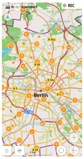
Wikipedia
Having Wikipedia on your trip helps you learn more about the places you visit. It is available offline and shows Wikipedia articles related to the points of interest right on the map.
Online maps
OsmAnd Online maps are an extensive addition to the OpenStreetMap database already present in the application. With this plugin, you can add layers to your map with information from various sources.
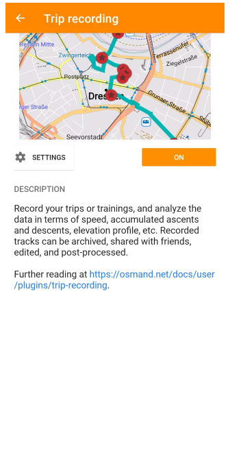
Trip Recording
To tell a story of where you have been, GPS data, as latitude and longitude of your location, can be recorded and stored in a file, and then re-used, improved, enhanced with waypoints, provided for navigation, shared with friends, etc.
Topography
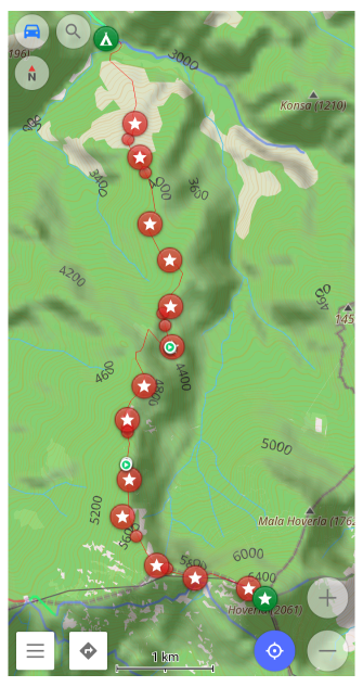
Topography information, such as Contour lines, Hillshade, Slope, 3D Relief, helps to make a visual assessment of the lay of the land by seeing elevation, relief, extremes, steepness, points of equal height, etc.
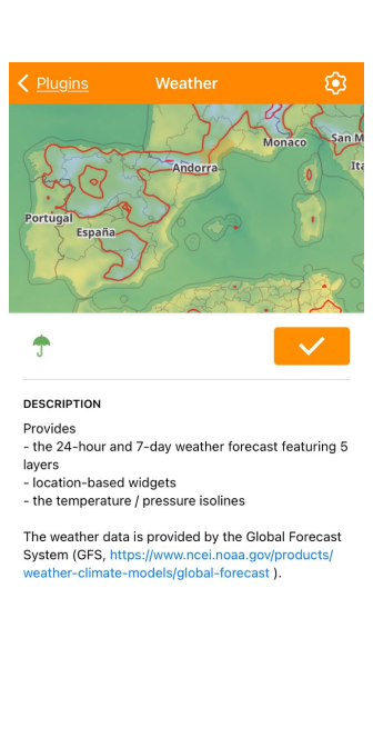
Weather
Shows the hourly forecast for the current day and for 7 days ahead.
Nautical Map View
Nautical map view provides detailed graphical representation of oceans, seas, coastal areas and rivers to help you navigate on the water, see popular traffic routes, obstacles in the waterway, harbors, anchorages, and other essential reference.
Ski Map View
Ski Map View shows winter colors and pistes downhill or cross-country, as well as cable cars, chairlifts, facilities and services nearby, which is useful for navigating destinations such as recreation areas, ski resorts and terrain parks.
Audio/Video Notes
Create audio/video notes for future reference, e.g. to remember a event, scene, or interaction. Created audio/video notes are available from My places as well as on the map as an individual layer of user-made stories and thoughts tied to a geolocation. For Android only.
Parking Position
Set a point on the map where your car is left on the street and notify your calendar when the parking time ends. This will make it easier for you to track the time and location of your car.
OpenStreetMap Editing
The OpenStreetMap editing plugin allows you to contribute to OpenStreetMap, a global community creating a comprehensive map of the world and providing publicly available up-to-date, open-source data.
Mapillary
See street-level views of your routes or places of interest, provided by Mapillary (an internet connection is required).
External Sensors
Connect external sensors to display their data in OsmAnd and store the information in track recordings.
Vehicle Metrics
Connect OBD-II scanner to display vehicle data in OsmAnd and store the information in track recordings.
Astronomy
Astronomy plugin displays an interactive star sky overlay with stars, constellations, the Sun, the Moon, and planets. It helps you identify celestial objects above your current location, preview their paths for a selected date and time, and plan stargazing sessions using built-in time controls and viewing options.
Accessibility
The Accessibility plugin makes the device's accessibility features directly available in OsmAnd. For Android only.
OsmAnd Development
The OsmAnd development plugin targets developers and experienced users. It allows you to simulate navigation routes, check screen rendering performance, etc.
OsmAnd Tracker
OsmAnd Tracker helps you see where your contacts are on the map in OsmAnd. For Android only.
AIS Vessel Tracker
Display AIS positions and information about surrounding vessels. The AIS data is received via network from an exteranl AIS receiver.
Create a Custom Plugin
You can create your own plugin by following Custom Package article.