Map Context Menu
Overview
The map context menu provides information about the selected object on the map. You can also use it to create a route to the selected location. To open the context menu, first, find the required location on the map, then select the object with a short tap or long tap when selecting any precise point on the map.
Select an Object (Single Tap)
- Android
- iOS
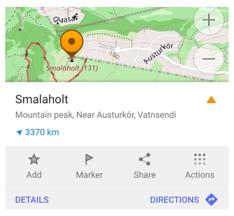
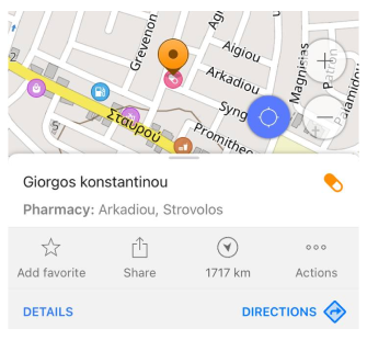
The context menu appears when you tap once a marked object on the map. This context menu displays essential information about the selected object, including its name, icon (as represented on the map), address, distance, boundaries and direction from your current position.
You can select various types of map objects, such as POIs, favorites, transportation stops, markers, mountain peaks, or other map objects.
- Selected map objects and their boundaries correspond to OpenStreetMap nodes or ways.
- The height of mountain peaks is displayed in meters or feet depending on the units of length selected in the profile settings.
Select Any Point (Long Tap)
- Android
- iOS

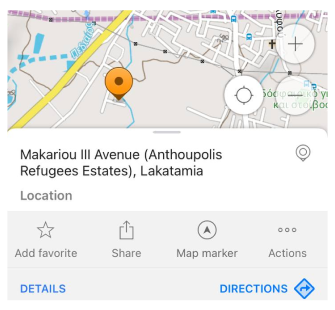
When you long tap anywhere on the map, a context menu appears, providing information about the selected location. This includes the address, distance, and direction from your current position.
Select GPX Route
- Android
- iOS
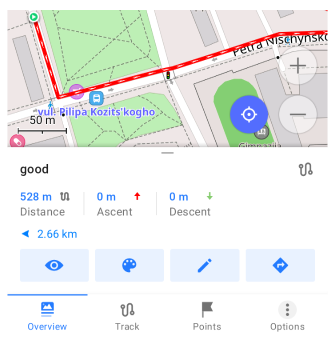
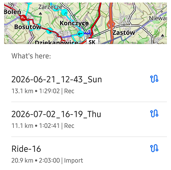
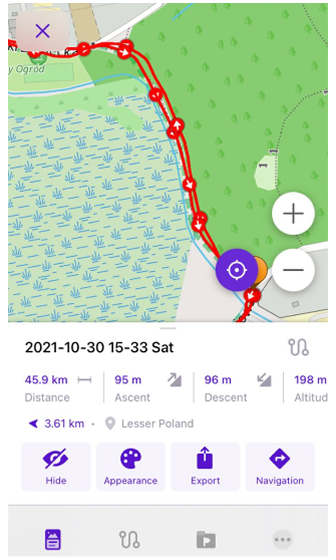
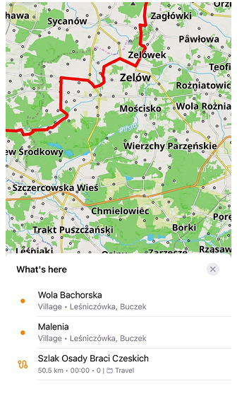
Tapping a GPX-track on the map opens the track context menu, where you can access additional track-related options. If the selected location contains multiple map objects, OsmAnd may first display the What's here list, allowing you to choose the desired object. For GPX tracks, this list shows summary information such as distance, duration, waypoint count, and the folder where the track is stored.
Routes, Ski Slopes, and Trails
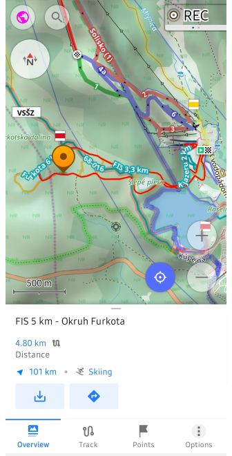
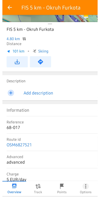
You can tap map elements such as ski slopes, mountain bike (MTB) routes, and dirt bike trails to open their context menu with detailed information. Check Routes article for more information.
Hide Context Menu
To close the context menu:
- Tap any empty area on the map to avoid reopening the menu.
- Drag the menu down from the top.
Details
- Android
- iOS
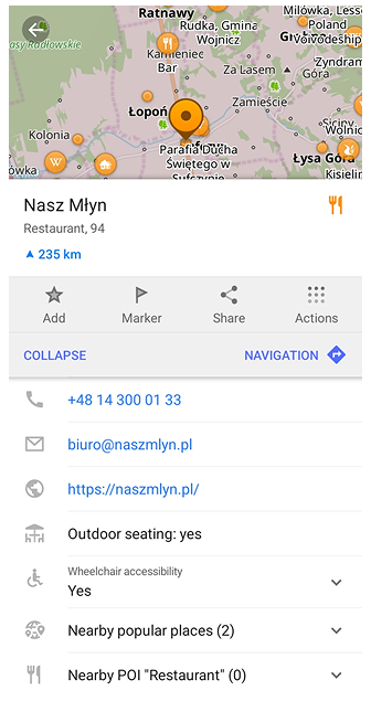
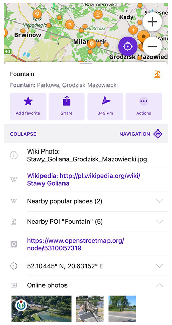
For more detailed information about an object, tap the Details button in the context menu or swipe the panel up to expand it.
Object Info
The Object Info panel provides additional details about the selected object. You can tap on any entry to copy the information to the clipboard.
Available details include:
- Article Description
- Alternative names
- Related
- Coordinates
- Within areas
- Nearby POIs
- Nearby Popular Places
- Guides (Android only)
- Public Transport routes for stops
- Favorites / Track Points from the same group
- OpenStreetMap link
- Online photos
Additionally, the panel may include OpenStreetMap Details, such as:
If a contact field (such as Website, Phone number, or Email) contains multiple values, tapping it displays a list of available entries. Select the desired entry to perform the corresponding action.
Beyond the fields listed above, OsmAnd may also show extra descriptive information taken from OpenStreetMap. These attributes help you better understand the characteristics of a place and can include details such as elevation, direction, year built, surface or covering type, indoor level, payment options, delivery or takeaway availability, and many others. OsmAnd displays these attributes with clear labels and, where possible, icons, making it easier to read and recognize the information. The exact set of attributes depends on what data is available in OpenStreetMap for the selected object.
Article Description
- Android
- iOS
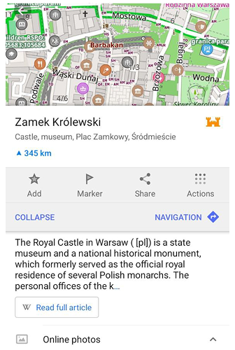
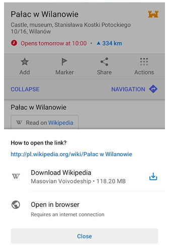
This part contains a part of the description from Wikipedia article, Favorite or Waypoint description, by tapping you can open the full description.
If the selected place has a Wikipedia article, a short preview is shown in this section. When the full article is not available offline, the Read on Wikipedia button appears. Tapping it opens a dialog with options depending on the user’s access: users with a purchased plan can download the regional Wikipedia data or open the article in a browser, while free users can open the article online or proceed to the screen that offers offline access.
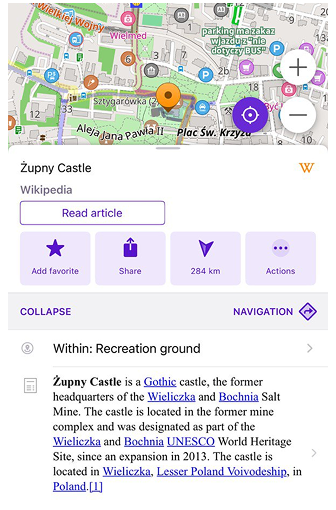
This part contains a part of the description from Wikipedia article, Favorite or Waypoint description, by tapping you can open the full description.
Alternative Names
- Android
- iOS
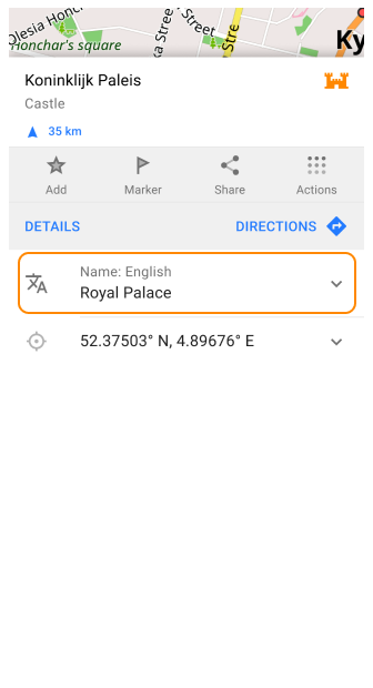
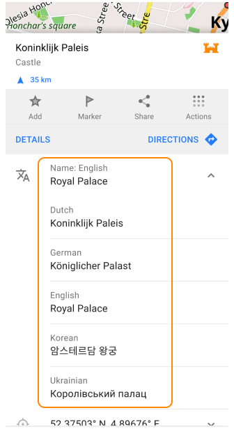
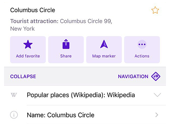
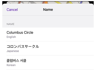
OsmAnd displays additional POI names in the map context menu, prioritizing the name in the display language or the system's preferred language list. If multiple translations are available, they are grouped into categorized tags such as name, brand, operator, or nearby POIs.
Features of alternative names display:
-
Additional translations can be accessed through a drop-down list.
-
Names are categorized into different groups such as the list of names in other languages, Regional, Local, National, International, Short, Old, Official, and Alternative names.
-
Other categories include region-specific translation, or default settings.
-
If a specific translation is not available, OsmAnd defaults to the local name to ensure accuracy and consistency across multilingual regions.
Related
- Android
- iOS
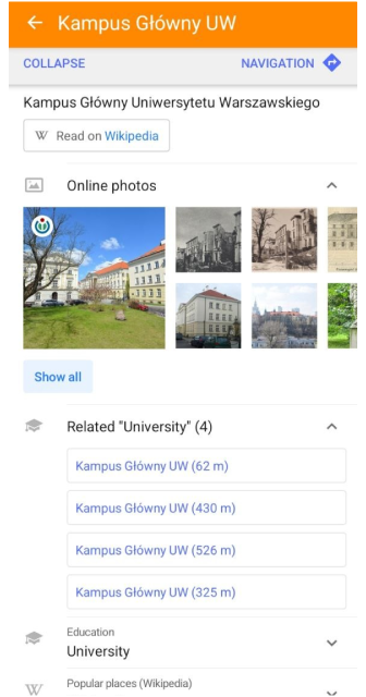
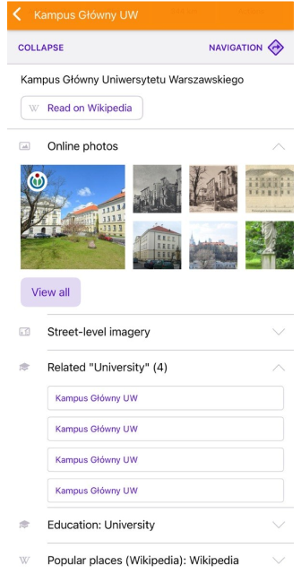
The Related section displays map objects that are associated with the selected place through an OpenStreetMap relation. This section is available for supported relation-based POIs, such as university campuses and other multipolygon objects.
Tap any item in the list to open its map context menu. This allows you to quickly navigate between related objects that belong to the same relation.
Within area
- Android
- iOS
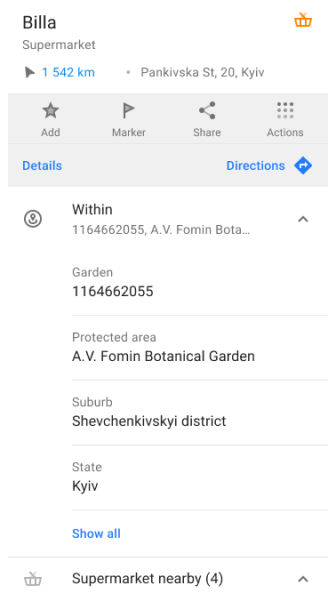
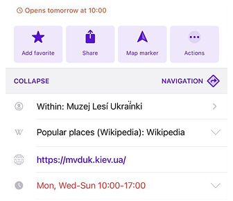
The Within Area feature lists the areas that an object is located within. This includes geographic features, administrative boundaries, land use areas, natural features, and other categorized areas. A list of surrounding polygons, sorted from smallest to largest based on area size.
Coordinates
| Coordinates format | |
|---|---|
| 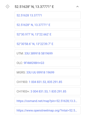 |
In the context menu, you can find geographical coordinates of a point in various formats and also shareable OsmAnd and OpenStreetMap Links (the last option is available only when the OpenStreetMap editing plugin is enabled). If you expand coordinates section and long tap any line from the list, its values will be automatically copied to the clipboard (Android) or the Copy option becomes available in the pop-up message (iOS).
OsmAnd Web Link can be automatically recognized by OsmAnd (example: https://osmand.net/map?pin=52.51628,13.37771#15/52.51628/13.37771). Both OsmAnd and OpenStreetMap links are opened on corresponding sites with a pin mark to the place of interest.
Nearby POIs
- Android
- iOS
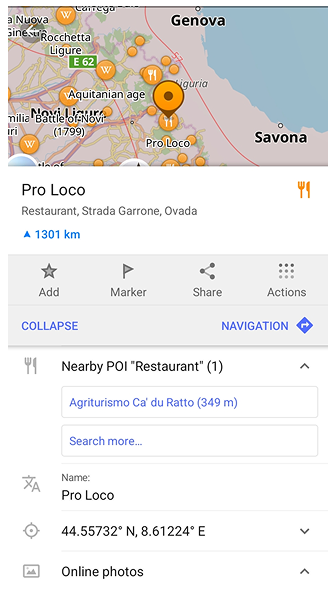
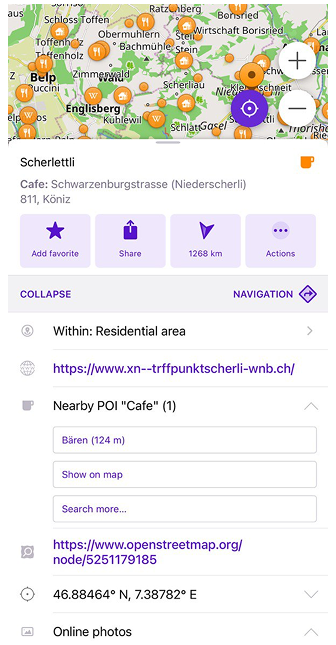
This section displays nearby Points of Interest with Show on map and Search more… to display and search all other POIs within the same category.
Tap Nearby POIs opens a points list. A tap to one of these points from a point list moves the map to this point with the opening point map context menu.
Nearby Popular Places
- Android
- iOS
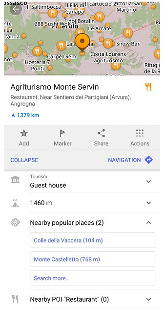
This section highlights popular places that helps you discover interesting destinations and landmarks around your current location. Use Show on map and Search more… to browse and search all popular places.
Tapping Nearby Popular Places opens a list of nearby locations. Selecting any item centers the map on that place and opens its context menu, where you can read a short description or tap Read full article to view the complete guide.
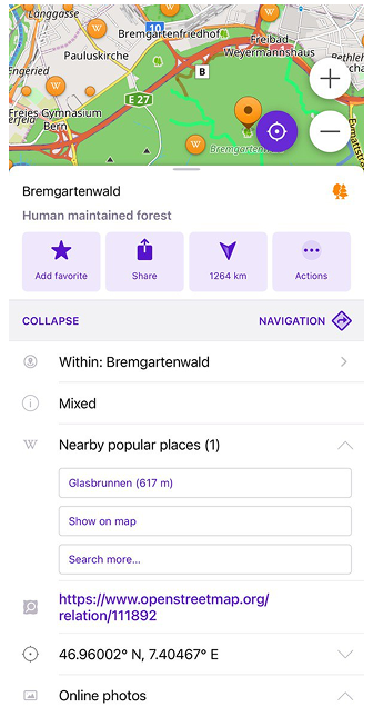
This section highlights popular places that helps you discover interesting destinations and landmarks around your current location. Use Show on map and Search more… to browse and search all popular places.
Tapping Nearby Popular Places opens a list of nearby locations. Selecting any item centers the map on that place and opens its context menu, where you can read a short description or tap Read full article to view the complete guide.
NOTE. Nearby popular places will appear only if you previously downloaded special maps with Wikipedia articles for this area.
Guides
This feature is currently not available for the iOS version of the OsmAnd app.
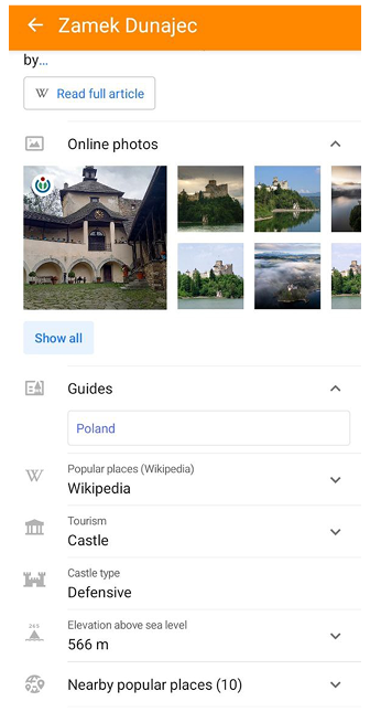
The Guides section appears in the map context menu for some places and provides access to Travel (Wikivoyage) guides related to the selected point of interest. It shows a list of guide entries (for example, a country or region) that mention the selected place.
The Guides section is displayed only if Travel (Wikivoyage) data is downloaded for the selected area.
Note: Guides are linked to Wikivoyage content, not to general Wikipedia descriptions.
Public Transport Routes
- Android
- iOS
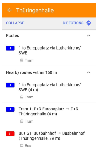
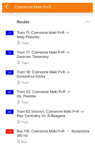
Shown info about Public transport routes for chosen transport stop. Information about Public transport context menu and actions with it, read in the article.
Favorites / Track Points from the Group
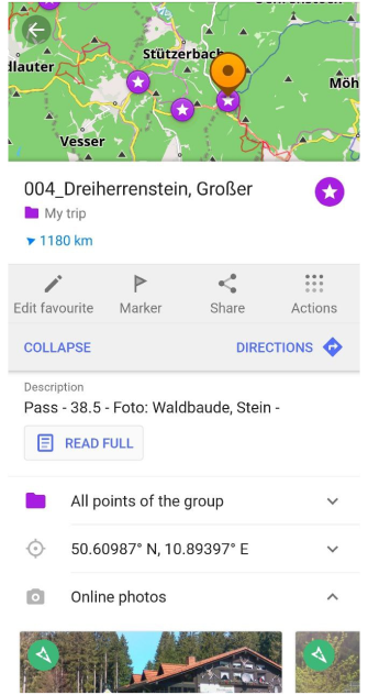
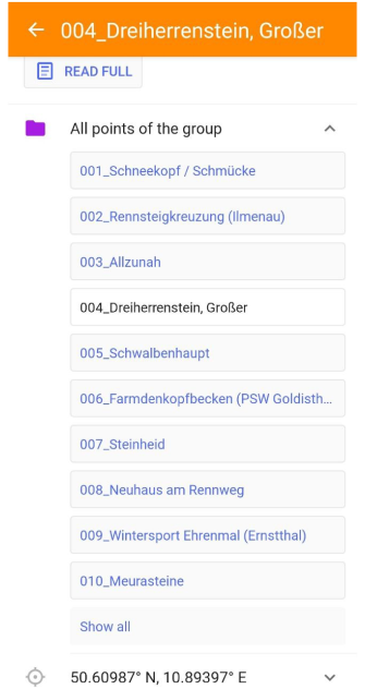
This is a list of all points in one group for a Favorite or Waypoint. By tapping, the entire list of points of one group expands, when tapping a point from the list, the map moves to the selected point.
OpenStreetMap Link
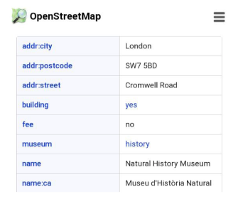
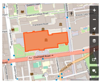
OpenStreetMap link provides direct link to the OpenStreetMap object where you can find complete information about it:
node or way.
Online Photos
- Android
- iOS
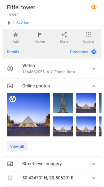
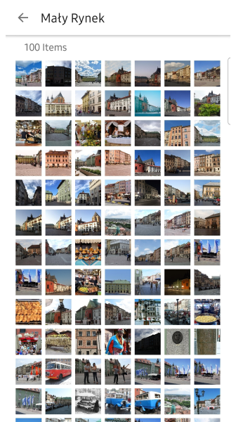
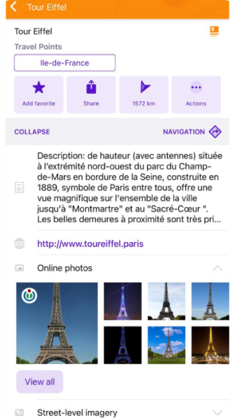
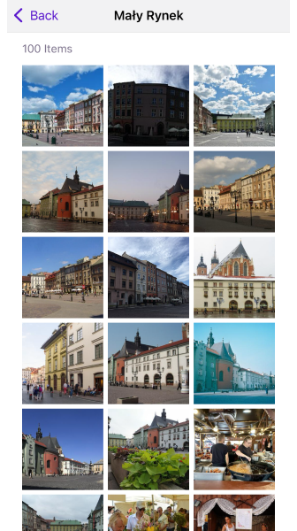
When you tap a Popular Place on map, the Online Photos section in the POIs context menu displays image previews sourced from Wikipedia and Wikimedia Commons.
Tapping a photo opens the Gallery view, where you can:
- Browse up to 100 images per place
- View image metadata (author, license, source)
- Perform actions: Share, Open in browser, Download
On iOS, long-tapping an image opens a context menu with quick actions.
For more, see: Online Photos and Gallery view
Street-level Imagery
- Android
- iOS
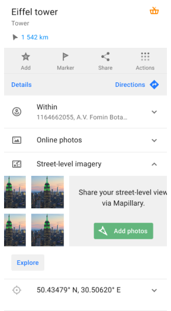
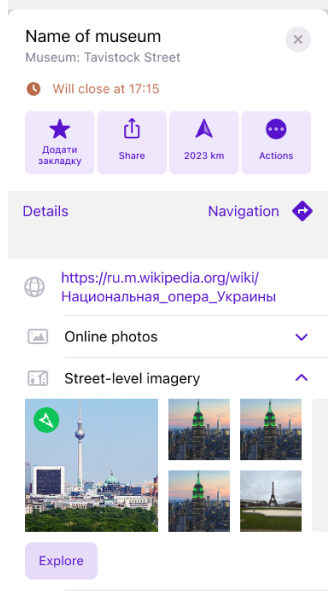
OsmAnd supports integration with Mapillary, a global platform for crowdsourced street-level imagery. This feature allows you to view and explore real-world photo sequences directly on the map.
Mapillary images appear as directional photo icons, aligned with the road or path where they were captured. These can help you better understand your surroundings, especially in unfamiliar areas.
You can:
- Use the Explore button to open Mapillary’s viewer and browse through nearby street-level images.
- Tap the Add Photos button to contribute your own photos to the Mapillary platform.
Learn more about how to activate and use this feature in the Mapillary plugin guide.
* Audio/Video Note
This feature is currently not available for the iOS version of the OsmAnd app.
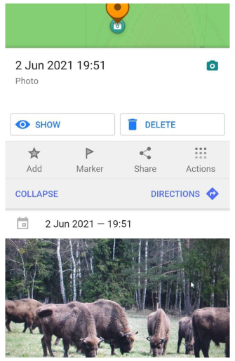
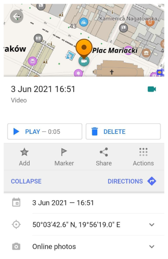
Audio / Video notes information such as date, coordinates, preview and others are available in the Details menu. You can open the notes in secondary software by tapping the Play / Show button in the context menu of the note.
Actions
- Android
- iOS
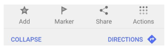
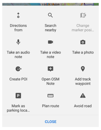

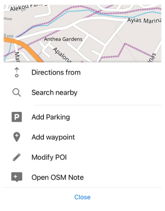
It is a set of specific manipulations that can be performed on a point or object. This menu is split into two parts: visible section consists of maximum 3 actions and other actions are accessible by Actions button. You can customize (Android) the order of actions in General settings.
Add / Edit Favorite
- Android
- iOS
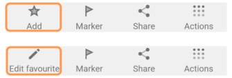
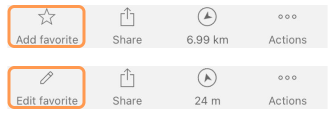
In the context menu, there are options to add or to edit the selected point / object to the favorites list.
-
To Add, you need to select a point / object, tap the Star icon (with signature Add) and enter all the necessary information.
-
To Edit information about favorite point, you need to turn on Show on the map (Menu → Me places → Favorites) then press on it and in the Context menu instead of Star icon will appear Pencil icon (with signature Edit).
-
Add or edit favorite - adds a selected point to the favorites list.
Add / Edit Marker
- Android
- iOS
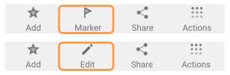
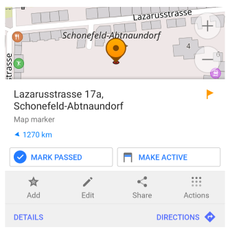
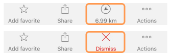
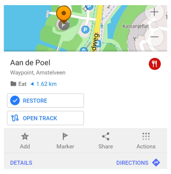
It is possible to mark a point or an object to make it easier to plan navigation. You just need to tap the flag icon in the menu (Android), arrow (iOS) - displays direction and distance to the selected point from your current location.
Actions:
- Marker / Edit map marker. Puts a new marker on the selected point.
- Mark passed (Android) / Dismiss (iOS). Deactivates marker and puts it to the History.
- Make active (Android). Moves marker to the top position (on the top panel).
- Restore marker (Android). Moves marker from History to active list.
Read more about markers here.
Share
- Android
- iOS
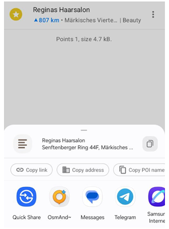
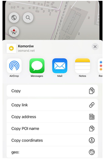
The OsmAnd app allows you to Share My Location or any selected location on the map with messenger, emails, or social media.
Available options to share the location:
- Send. Sends text through apps available on your device. Includes all information about the location: My location name or the name of the selected POI, address, coordinates, and geolocation as a link.
- Copy link. Copies a link to the selected location to the clipboard.
Example:https://osmand.net/map/poi/?name=Tour+Eiffel&type=Tourism&pin=48.85826,2.29449 - Copy. Copies all location information (My location name or name of the selected POI, address, coordinates, and geolocation as a link) to the clipboard.
- Copy address. Copies only address information to the clipboard.
- Copy POI name. Copies only POI name or address if there is no name to the clipboard.
- Copy coordinates. Copies only coordinates information to the clipboard.
- geo. Opens a list of available applications that support geolocations.
- QR-code (Android). Generates a link to the selected location in a QR code.
Directions To / From
- Android
- iOS
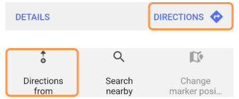
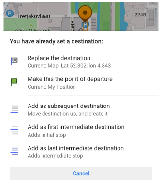
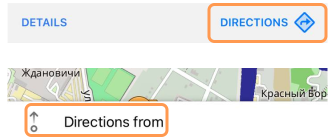
To start navigation or route planning, you need to select destination first with Directions. In case you already have a destination point, the menu will suggest you to replace the destination point or to insert as another intermediate or start point.
It is also possible to select From Destination first via map context menu (Directions from).
Read more about navigation here.
If you tap Start navigation - From point will be discarded as application enters in Navigation mode. To preserve a route, don't tap Start navigation and swipe down Route preparation menu.
Search Nearby
- Android
- iOS


With this context menu action, it is possible to search around a specific location on the map.
Read more about search functionality.
Avoid Road
- Android
- iOS
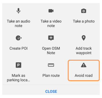
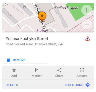
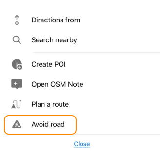
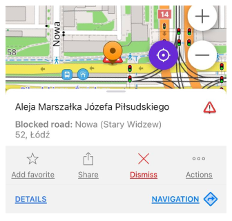
Using map context menu, you can add a specific road to the list of non-used for routing roads. That will affect route preparation.
To delete previously selected roads from Avoid roads list tap a sign, choose Remove (Android) or Dismiss (iOS).
Avoid roads function is global and affects all routing types (except Online routing).
Change Object Position
- Android
- iOS

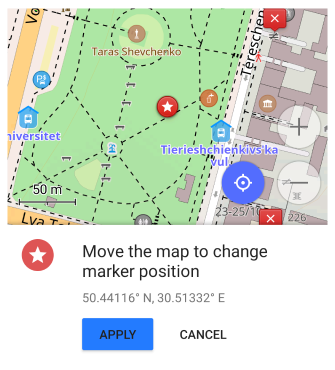

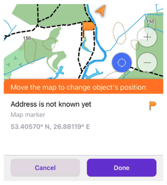
Almost every created object by user is moveable i.e. Marker, Favorite, Created POI, Audio/Video Note or Track Waypoint. First select an object on the map and then use Change marker position the menu to move it to a new location.
Plan a Route

You can start a route planning from a selected point via object context menu.
Read more about Plan a route tool.
Update / Download Online Maps
- Android
- iOS


To update or download online maps (tiles) at a specific location, you can use the context menu of the object:
- Android: Download map and for Update, go to: Menu → Maps & Resources → Updates.
- iOS: Download map and Update.
Please read the full instruction.
Update / Download Vector Maps
- Android
- iOS
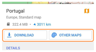
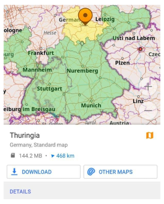
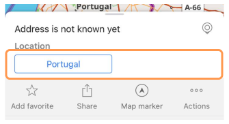
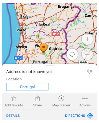
In case there is no offline map present at the selected location, for example map object menu was opened via Search or via specific Favorite, then the smallest possible offline map will be suggested to download.
iOS. If you already have downloaded OsmAnd maps (vector or terrain), it is possible to updated them via context menu. You will need to select the region on the map first - tap any location on worldwide zoom 3-7.
NOTE. If you have opened context menu for map region (region is highlighted), you will be able to see Details about it: type and size of an available map, link to a Wikipedia page, language, population and other.
* Add / Delete Parking point
To add add/delete parking points, enable the OsmAnd Parking position plugin.
- Android
- iOS

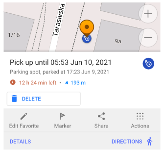

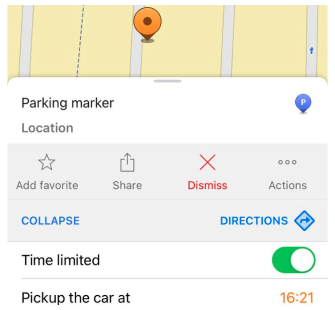
Any selected location on the map could be marked as a parking position. To delete parking position, you can open the context menu associated with parking location.
* Add / Edit Track waypoint
To add add/edit track points, enable the OsmAnd Trip recording plugin.
- Android
- iOS
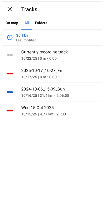
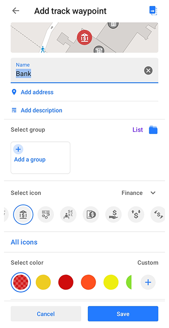

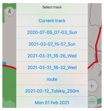
You can add waypoints to a recorded track or to the current track recording using the map context menu.
- Select a location on the map with a long tap.
- In the map context menu that opens, choose Actions → Add track waypoint.
- The list displays the tracks recorded and shown on the map, as well as the current track recording, to which you can add the selected waypoint (on Android, the list is grouped into tabs: On map / All / Folders).
- You can add waypoints to a track that is not yet active for recording, in which case the inactive track switches from the Start state to the Resume state.
- Fill in the required data and save the waypoint.
- You can configure the Quick Actions by adding a waypoint to the Add track waypoint.
* Create / Modify POI
To add create/modify POIs, enable the OsmAnd OSM Editing plugin.
- Android
- iOS
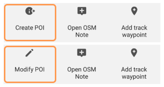
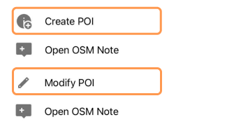
With OSM Editing plugin, you can create and modify most of the POIs present on OpenStreetMap.
- Create POI - creates a new POI at selected location.
- Modify POI - modifies selected POI.
* Open OSM Note
To add open OSM note, enable the OsmAnd OSM Editing plugin.
- Android
- iOS

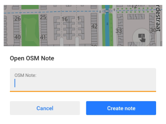

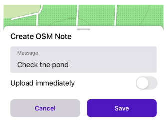
You can report map data errors at specific location to OpenStreetMap community. Please follow guidelines and add proper comments to an issue.
* Comment / Close OSM Note
To comment/close OSM note, enable the OsmAnd OSM Editing plugin.
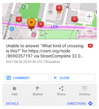
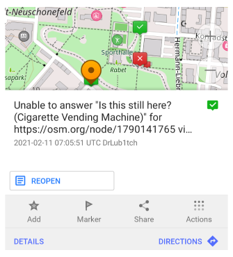
You can comment, resolve and reopen OpenStreetMap Notes via object's context menu.
* Upload POI / OSM Note
To upload POI / OSM note, enable the OsmAnd OSM Editing plugin.
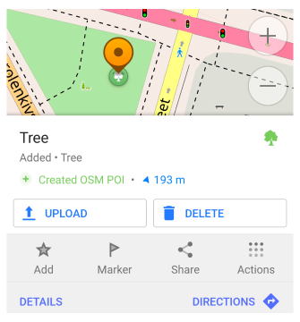
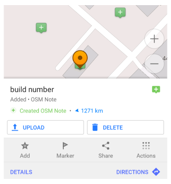
In case you use Offline mode to add / edit POI or OSM Note, you will need to upload the changes to OpenStreetMap. By default, Offline mode is on to avoid accidental changes of public database. You can upload or delete change via created object context menu.
* Record AV Note
This feature is currently not available for the iOS version of the OsmAnd app.
To record audio/video notes, enable the OsmAnd Audio/Video Notes plugin.

Records or takes a media note at a selected point on the map.
- Take an audio note - makes a audio note on selected point (creates new point on the overlay with audio icon).
- Take a video note - makes a video note on selected point (creates new point on the overlay with video icon).
- Take a photo - makes a photo point on the map.
Customize
This feature is currently not available for the iOS version of the OsmAnd app.
Menu → Configure profile → UI Customization → Context menu actions
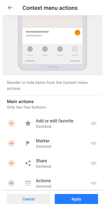
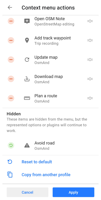
You can change the order or hide items from the menu Actions in the map context menu. A total of 16 actions are suggested.
- You can move the three most useful actions to the top of the Main actions list.
- The rest of the menu can be customized for each profile separately in the Additional actions and Hidden sections.
Available types of actions:
- Main actions. The section has only 4 buttons, three of which can be customized, and Actions, which remains unchanged.
- Additional actions. You can access these actions by tapping the Actions button.
- Hidden. Moving actions to this section does not stop them from working. They just don't appear in the Actions menu.