Nautical charts

OsmAnd 2.0 is coming soon. One of the new features of the version will be Nautical Charts plugin. Nautical Chart is a detailed graphical representation of oceans, seas, coastal areas and rivers.
Nautical Charts are made for people who drive any kind of vehicle on water: from professional sailors to people who rented a boat to make a tour over city canals. The charts can contain various information like sailing routes, navigation lights, dangerous areas, areas where it's allowed or not allowed to sail or dock, etc.
All the professional sailors are obliged to have official nautical charts on their ships. These charts are published by authorized agencies and cost quite some money. Agencies are investing a lot in keeping the charts up to date. They release updates for the charts on regular basis, but because of the fact that reviewing the information and processing the updates takes quite some time the nautical charts are never completely up-to-date.
Nautical charts of OsmAnd are based on the data from OpenSeaMap project. The idea of the project is to build the detailed map by people how actually use it. Every user of the map can contribute by adding changes to it making it more detailed and more accurate.
While OpenSeaMap charts at the moment cannot compete with official nautical charts, they can be used by recreational sailors for orientation or route planning.
Let's look into a couple of concrete scenarios when OsmAnd nautical plugin can be useful.
Recreational sailing in the sea
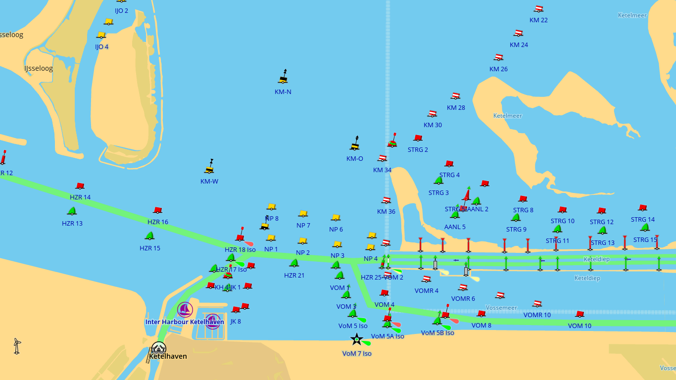
Imagine you've decided to rent a boat and make a small voyage in the area you don't know so well. You want to have a relaxed and safe trip, so you choose the places you want to visit, routes how to get there, check areas where you can make fast and, if any, dangerous or forbidden areas around. The map of the shore area will give plenty of information regarding places which are worth visiting or restaurants where you can have a nice lunch.
In case you hadn't managed to get back before it got dark or it was a planned romantic time to see the stars, but you don't feel so confident with the orientation, the OsmAnd can tell your position and show where the sea lights are located so that you can use them to choose the proper way.
Boat trip in a city
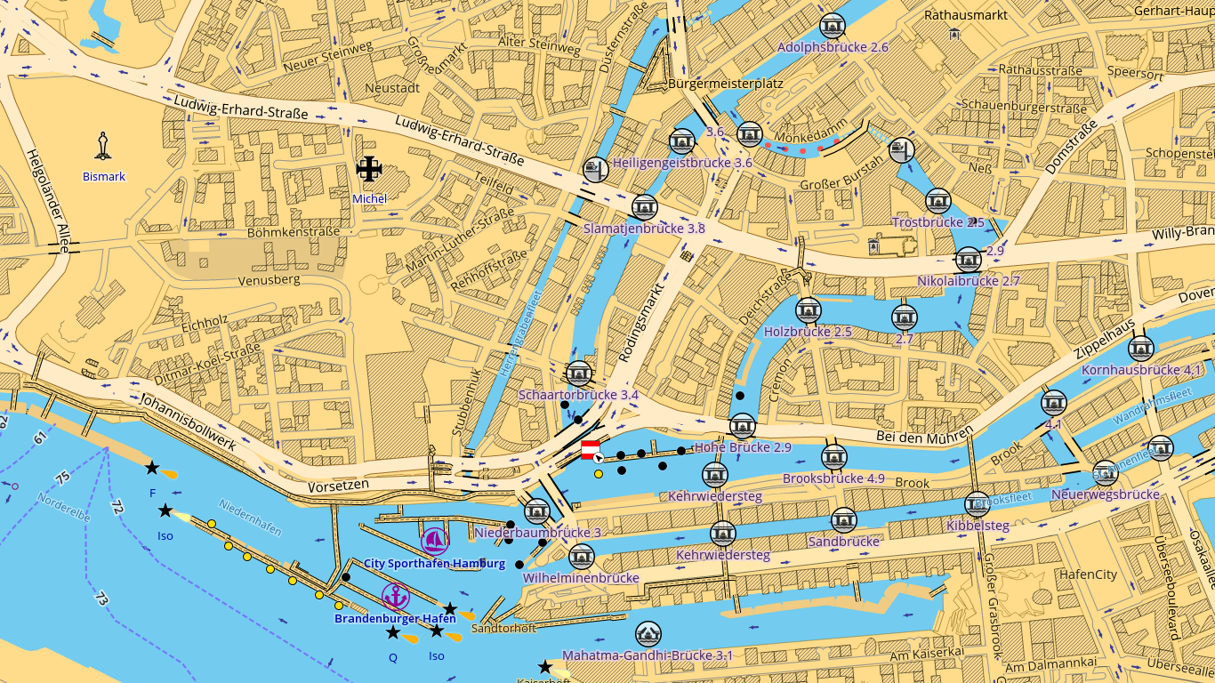
This is a nice sunny day. You have been looking forward to this day and finally your idea to make a boat trip with your friends or family comes true. The boat is arranged, the basic information how to sail on it is learned. Whether you like to plan everything in advance or prefer to follow your inspiration OsmAnd can give you information which routes you can follow and which of them are forbidden, which bridges you can meet on your way, what is the height of the bridges, which of them can be opened and which of them you better avoid - all the basic information you need to have a pleasant and relaxed time on the water.
Whether you already have a boat or you just thinking about your first voyage Nautical Charts plugin for OsmAnd can be a very useful tool which will give the information you need to feel more comfortable and confident on your way. And the best thing – you can always improve the charts yourself making them better for you and other OpenSeaMap users.
Join us at our groups of Telegram (OsmAnd News channel), (EN), (IT), (FR), (DE), (UA), (ES), (BR-PT), (PL), (AR), (TR).


