OsmAnd 4.3 (Android)

Great news for Android users!
We're happy to announce the new 4.3 OsmAnd release for Android devices.

What's news:
- New faster map rendering engine.
- Smooth animation for location changes during movement.
- Weather plugin.
- New improvements for Widgets:
- Added widget with coordinates of map center;
- "Distance to tap" added text size option;
- ETA for "Map marker" widget;
- Weather widgets;
- Developer widgets;
- Sunrise, sunset widgets.
- Reorganised "Nautical maps".
- Added ability to switch Mountain bike routes scheme classification.
- GPX added support for "link", "cmt", "desc" tags and for any custom extensions.
- Added option to disable UUID.
- Add new data on the map.
- More:
- Fixed "Display position" option;
- Added support for ANT+ sensors;
- Favorites local backup;
- Added Map data;
- Elevation-dependent speed;
- Fixed slider behavior;
- Show/hide layer of downloaded maps.
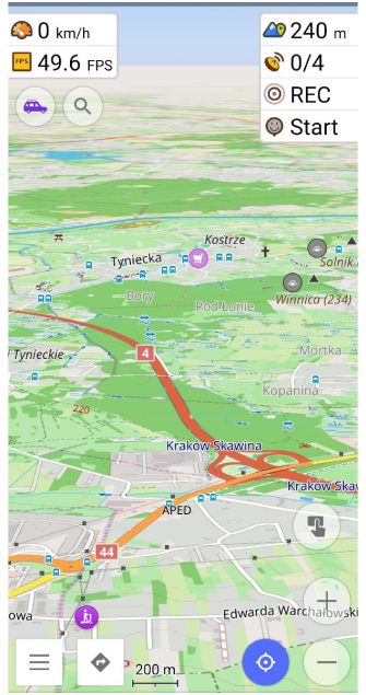
New faster map rendering engine
In the previous release of OsmAnd 4.2, we added this feature for testing. Now, OpenGL rendering engine is available by default.
Be sure to check that you have OpenGL render mode enabled:
Menu → Settings → OsmAnd settings → Map rendering engine → Version 2 (OpenGL)
2.5D projection
The setting for Enable/Disable 2.5D view is located in profile settings:
Menu → Configure profile → General settings → 2.5D view
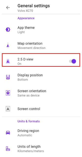 |  |
When 2.5D view is enabled, you can change the view angle by gesture Tilt or by My location button.
Smooth animation
Routing animation (icon movement during navigation) works smoothly now.
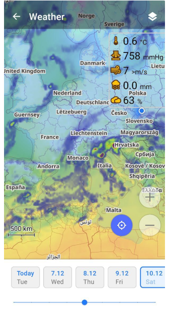
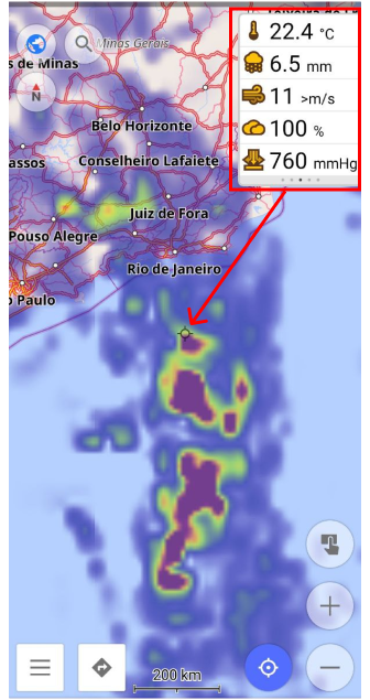
Weather plugin
Added a demo version of the Weather plugin. This is a Pro feature:
- weather map layers: Temperature, Air pressure, Wind, Cloud, Precipitation.
- weather widgets.
 |
New improvements for Widgets
Check out the new features we added to the widgets in this release.
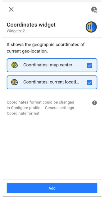
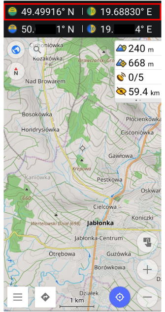
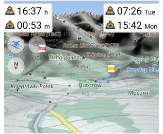
Coordinates widget: map center
"Coordinate widget - Map center" was added. Users can quickly find coordinate info for any points on the map. For Coordinates widget you can show Map center and / or Current location info panel on top of the screen device:
Menu → Configure screen → Widgets → Top panel → Coordinates widget → Coordinates:map center / Coordinates:current location
The green icons are Map center coordinates, and the blue icons are the My location coordinates.
 |  |
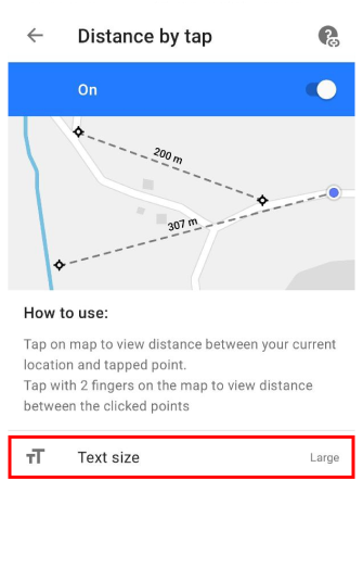
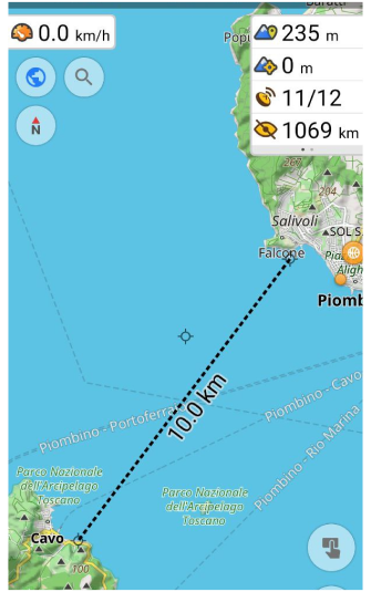
Improvement of Distance by Tap
Now, it is possible to change the text size for info on the Distance by Tap tool:
Menu → Configure screen → Buttons → Distance by tap → Text size → Large / Normal
 |  |
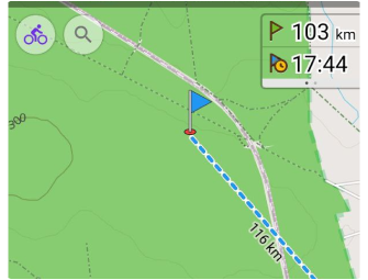
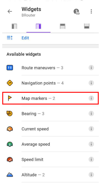
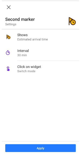
Improvement of Map marker widget
Map marker widget can now show the _ Estimated Time of Arrival (ETA)_ and not only the distance to the Map marker.
 |
At first, you need to add Map marker widget to the left or right panel: Menu → Widgets → left / Right panel → Map markers. Then you need to check the settings of these widgets by tapping ⚙ button.
 | 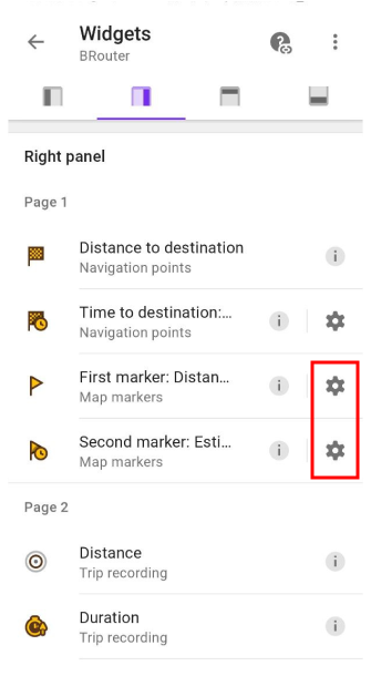 |
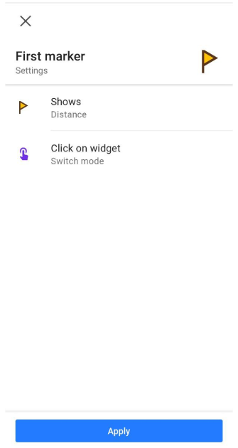
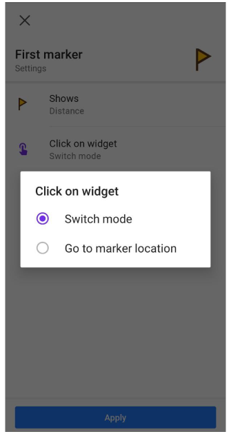
Here you can choose what widget will be shown: Distance or ETA. Also, what action will be performed tapping the widget: Switch mode or Go to marker location.
Switch mode changes the mode from Distance to ETA and vice versa.
Go to marker location moves the center map to the chosen Map marker.
 |  |
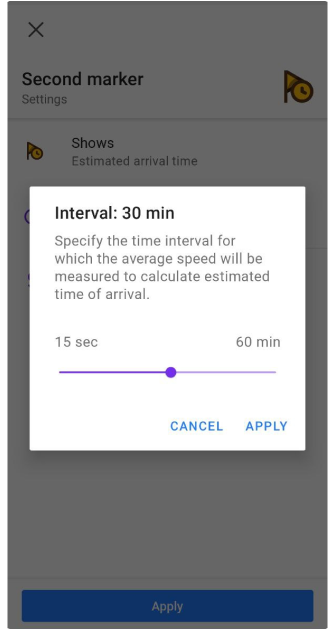
Estimated arrival time (ETA) widget allows you to specify a time interval for speed averaging (used for arrival time estimation).
 |  |
Weather widgets
Weather widgets show current weather data for the central point on the map:
Menu → Configure screen → Right panel / Left panel → Weather → Temperature, Air pressure, Wind, Cloud, Precipitation
 |
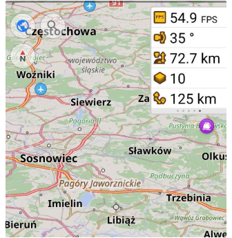
Developer widgets
Added developer widgets, such as Map Rendering FPS, Camera tilt, Camera elevation, Zoom level, Distance from camera to taget:
Menu → Configure screen → Right panel / Left panel → Developer widgets
 |
Sunrise and sunset widgets
Added Sunrise, sunset widgets. These widgets show "Time left" of time of next sunrise or sunset. It's clickable widgets:
Menu → Configure screen → Right panel / Left panel → Sunrise, sunset
 |
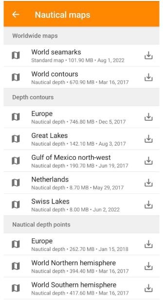
Nautical maps folder
We reorganised "Nautical maps" folder in Download maps menu. Now, there are three sections in this folder: Wordwide maps, Depth contours, Nautical depth points.
 |
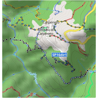
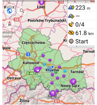
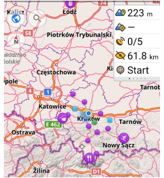
MTB IMBA trails
OsmAnd now renders the MTB IMBA trials on the map. You need to switch on Show MTB IMBA trails in Menu → Configure map → Routes.
Here is an example of the MTB IMBA icons for the trails and the legend for those icons:
 |  |
Disable UUID
What's been done by sorted by priority:
- It is possible to disable sending UUID (Unique User Identifier) in the Privacy Global Settings. As a result, the traffic could be deprioritized when a lot of cards are loaded, usually at the beginning of the month.
- UUID is rotated every 3 months so there is no user profile built for a longer history.
- ToS with explanation has been updated https://osmand.net/help-online/terms-of-use/.
- There is a clear indication on the first screen after installation and a link to ToS.
New updates for GPX files
- Favorites: show content of
<cmt>tag similar to waypoints, phone numbers for the Waypoint, attributes name, desc, cmt, link:
<wpt lat="30.297375" lon="-87.4320327">
<name>Caf� Beignet</name>
<cmt>Open 6:30 am to 12:00 pm. Closed Sun & Wed</cmt>
</wpt>
- Phone numbers for the Waypoint attributes:
<wpt lat="52" lon="5">
<extension>
<phone>My phone number</phone>
<website>https://test.website</website>
<comment>Comment</comment>
<extension>
</wpt>
- Tags for description: name, desc, cmt, link.
 |
More
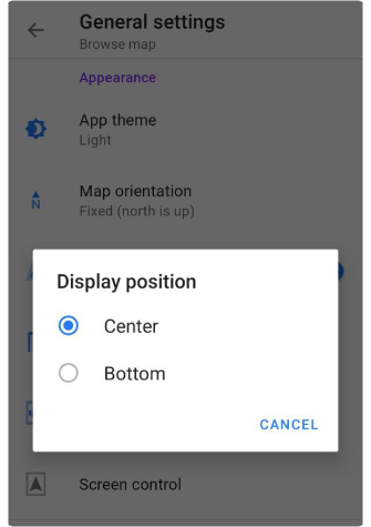
Display position
Changed the Appearance setting for Profile "Display position always in centre" to "Display position", where the user can choose two parameters: Center or Bottom.
 |
Support external devices ANT+
At this release, we added support for external ANT+ devices (speed, cadence, heart rate, distance, cycle power, temperature). The support external Bluetooth devices is planned for the next release.
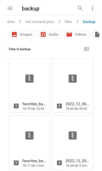
Favorite local backup
Every time you save or edit your Favorites, a backup file (favorites_bak.,gpx.zip) is created in the backup folder:
...net.osmand → files → backup
 |
Added Map data
We added and changed the following data to display on the map:
- POI with tag club key: the full list you can find here.
- Added more filter options for Swimming POIs.
- Tag emergency=lifeguard.
Elevation-dependent speed
This is the default adjustable speed forecast for walking/hiking/running trip time depending on elevation.
For activities such as walking or running, set the default speed for flat terrain in the Walking profile to the value you expect (usually 4 km/h). Then all route calculations for this profile will more accurately predict the corresponding trip time based on the actual elevation gain. To do this, the "Use elevation data" option needs to be set and the elevation data needs to be present on your device.
Fixed slider behavior
Fixed some bugs related to the reliable use of the selected audio stream and activation of the volume control for this particular stream.
Downloaded maps layer
Added the ability to show or hide the layers of downloaded maps:
Menu → Configure map → Show → Show borders of downloaded maps
 |  |
Follow OsmAnd on Facebook, TikTok, X (Twitter), Reddit, and Instagram!
Join us at our groups of Telegram (OsmAnd News channel), (EN), (IT), (FR), (DE), (UA), (ES), (BR-PT), (PL), (AR), (TR).

