Routes on the map


Hi, Everybody!
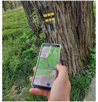
There are thousands of official and nonofficial routes which symbols (marks) you can see in cities, forests and etc. All these routes are routes for your activities. Many of them exist in OpenStreetMap and you can see them online here for example.
Routes
In OsmAnd you can highlight routes (present on OpenStreetMap) and hiking symbol overlay for your activities. It may be useful for your cycling, hiking, etc. You can select multiple routes at once though they will be displayed as layers and if the road has multiple routes over it only top colour will be visible. If you have some specific rendering styles enabled, you could have a bigger routes variety i.e. for Snowmobile style you could select Snowmobile routes.
Show routes on the map
To configure it, follow these steps:
Android Menu → Configure map → Routes
iOS [object Object] → Configure map → Routes
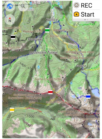
Choosing routes in OsmAnd
While this feature works only for Android version of OsmAnd.
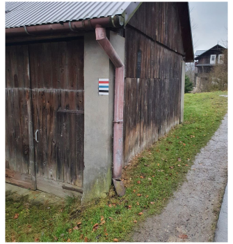
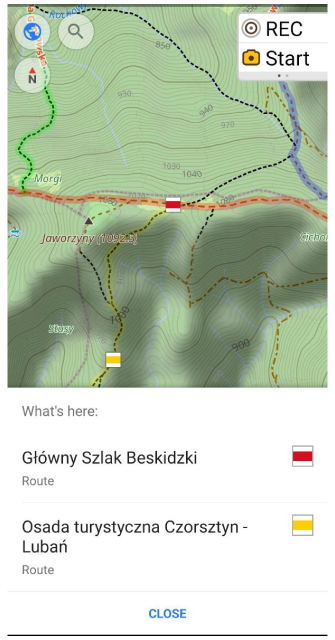
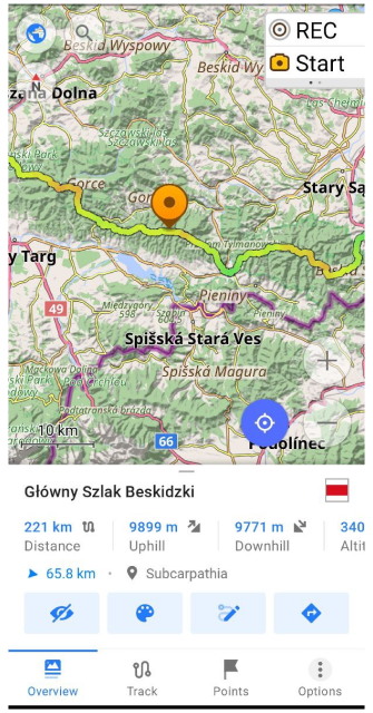
Hiking / Cycling / Travel routes are clickable. Just tap the route symbol, get full route information and download the GPX file for the selected route. (Routes are marked on the map with OSMC symbols.)
Clicking on a shield (OSMC symbols) proposes to choose the nearest routes.
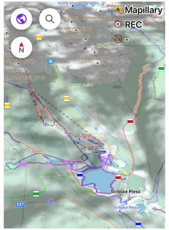
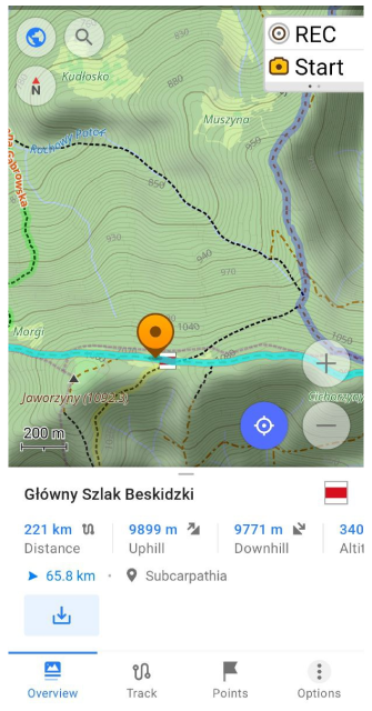
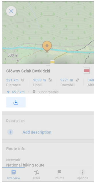
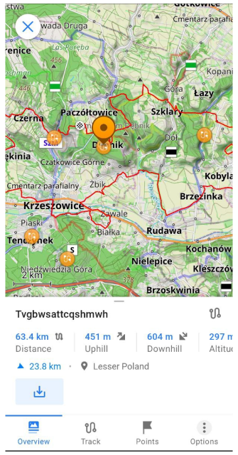
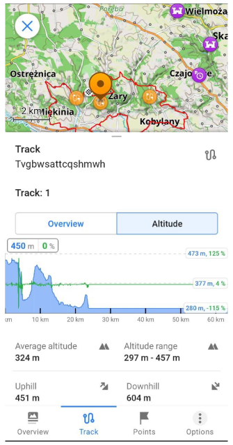
Choosing the route opens Track Context menu:
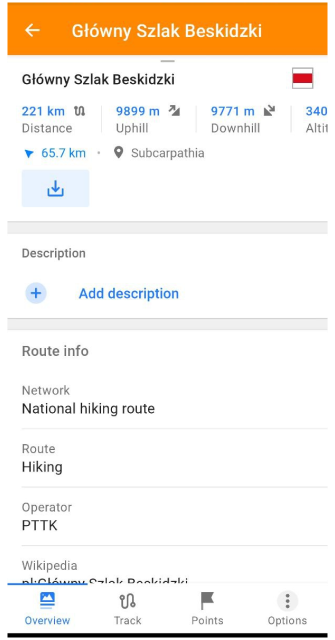
You can view the route, and its relief, download it as a GPX-file, edit it with "Plan route" tool and even start navigation along it:
- look at Route info (Distance, Uphill, Downhill, Altitude range, Route name, Network, Operator, etc.).
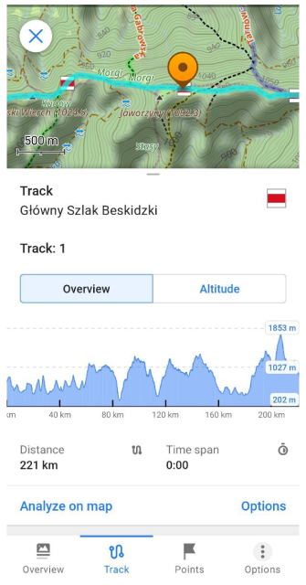
- looking at Altitude Graph, Analyze on map, Share like GPX-file and etc.
- download the route like GPX-file by clicking to "Download" button. After that, you can do any actions with this GPX-file (navigation, change viewing, modifying by "Route plan" tool and etc).
Generated Travel Routes
While this feature works only for Android version of OsmAnd.
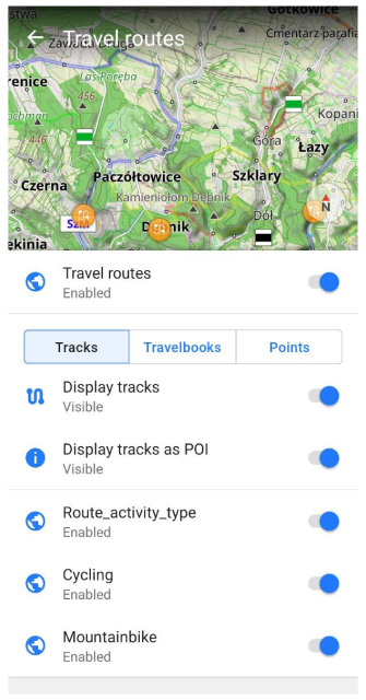
OpenStreetMap users upload hundreds of Public GPS Traces every day. OsmAnd backend team can download these GPS tracks, sort these by categories (hiking, cycling and etc.). After we generate OBF-file with these tracks which you can add to OsmAnd like one of Vector layers. Settings of this layer you find here:
Android Menu → Configure map → Routes → Travel routes
For example, we can download generated OBF-files with Public GPS Traces:
Clicking on this file adds the OBF-file to OsmAnd Local folder.
Now, we can switch on 'Travel routes' and view POIs of routes on the map:
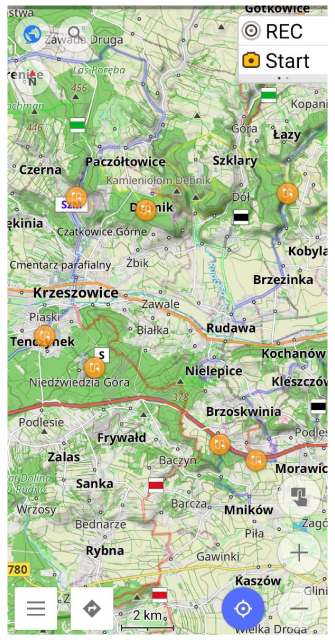
Clicking on POI opens Track Context menu of travel routes like it is done for Routes. You can download GPX file of chosen Travel route, and view all route info:
Advantages of OBF-file:
- small file size.
- search for tracks directly on the map.
- the ability to make your own OBF-files with GPX-tracks: upload GPX-tracks and get OBF-file (with a name "xxx.travel.obf").
OsmAnd Poll
Follow OsmAnd on Facebook, TikTok, X (Twitter), Reddit, and Instagram!
Join us at our groups of Telegram (OsmAnd News channel), (EN), (IT), (FR), (DE), (UA), (ES), (BR-PT), (PL), (AR), (TR).


