Hello, everyone!
We are pleased to announce the release of a 4.6 version of OsmAnd for iOS devices. Update it at the AppStore.

Hello, everyone!
We are pleased to announce the release of a 4.6 version of OsmAnd for iOS devices. Update it at the AppStore.

Hello, everyone!
We are glad to introduce you to the article from our Finnish advanced user Antti from his blog.
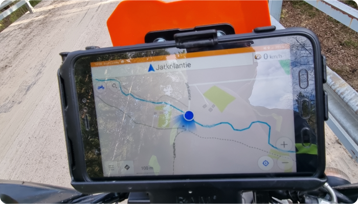
☛ Let's go!
Hello everybody!!!
In the latest release of OsmAnd Android 4.5.6 we have created a special plan for our dear users - OsmAnd Start. What does it mean?
It is an opportunity to use OsmAnd Cloud absolutely FREE of charge.
You can take advantage of free cloud backup of your Favorites, Settings, and OSM edits/notes. (Cloud storage 5 MB).
This plan will soon be available for the iOS version of OsmAnd as well.
☛ Let's go!
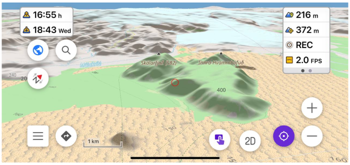
Hello everybody!
In the OsmAnd 4.5 release, a new terrain map type has been added. This is a new data type in our application, which is needed for terrain rendering, and for some additional functions related to elevations. All the information is in our documentation, but in this article, we will describe how and what you can see and get on the screen with a new data type.
☛ Let's go!
Good news, everybody! Revolutionary changes we made in 4.5 OsmAnd release for Android devices. Go ahead and read all what was added and improved.
Big Spoiler:

Hello everybody!
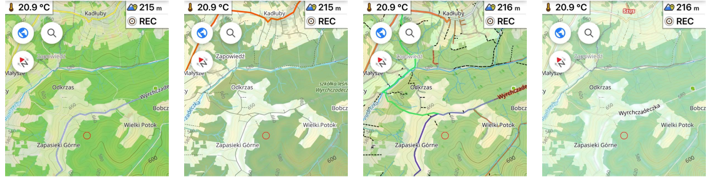
This article is about one of the general OsmAnd killer-feature - Online maps plugin. This Plugin allows us to enable and add other map sources for OsmAnd. All of these sources are raster maps.
Raster maps come from various sources and they complement OpenStreetMap data, and sometimes they are the only source. By combining map layers, you can get the best picture on your screen:
Hello everybody!
In this article, we want to show you how OsmAnd users create their own map styles.
At first about Map styles by default.
OsmAnd contains own 10 map rendring styles: OsmAnd, Touring view, UniRS and LightRS, Nautical, Winter and ski, Topo, OSM-carto, Desert, Offroad, Snowmobile.
Android version: Menu → Configure map → Map rendering → Map style
iOS version: Menu → Configure map → Styles for offline maps
Hello, everyone!
We are pleased to announce the release of a new version of OsmAnd for iOS.

Happy birthday, OsmAnd! Come and join the celebration (and get your gift) ✨