Tipi di percorsi
Panoramica
I percorsi rappresentano diverse attività all'aperto utilizzando dati da OpenStreetMap. Toccando l'icona dello scudo con un numero di percorso o una bandiera di percorso sulla mappa si aprirà un menu contestuale che fornisce informazioni aggiuntive sul percorso e consente di utilizzarlo come parte della navigazione.
Puoi configurare il filtraggio di alcuni tipi di percorsi nel menu Configura mappa.
Ciclismo
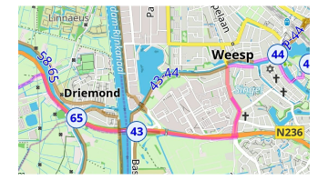
Percorsi ciclabili sono presenti nei seguenti tipi: locali (lcn), regionali (rcn), nazionali (ncn), internazionali (icn) e non classificati. Inoltre, i percorsi ciclabili potrebbero far parte di Reti di nodi. Puoi scegliere come assegnare il colore ai segmenti del percorso:
-
Percorso.
-
Nodo reti.
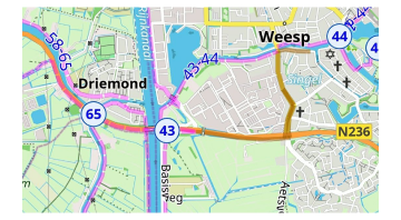
Puoi trovare maggiori informazioni nell'articolo Legenda della mappa.
Mountain bike
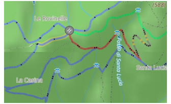
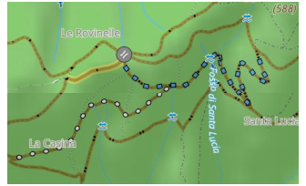
I percorsi MTB hanno una mappatura specifica in OpenStreetMap e possono essere selezionati separatamente dai percorsi ciclabili.
-
Scala di difficoltà per MTB. Mostra i sentieri secondo la scala MTB. Ulteriori informazioni sono nell'articolo Legenda della mappa.
-
IMBA. Mostra i sentieri MTB secondo l'International Mountain Bicycling Association, MTB IMBA. Ulteriori informazioni sono nell'articolo Legenda della mappa.
Escursionismo / Camminata
Percorsi escursionistici sono presenti nei seguenti tipi: locali (lwn), regionali (rwn), nazionali (nwn), internazionali (iwn) e non classificati. Inoltre, i percorsi pedonali potrebbero far parte di Reti di nodi. OsmAnd non separa i percorsi pedonali e quelli escursionistici e li combina in un unico gruppo. Puoi scegliere come assegnare il colore ai segmenti del percorso:
-
OSMC. Colora i percorsi in base al loro colore locale individuale (se disponibile in OpenStreetMap) e al simbolo dello scudo turistico.
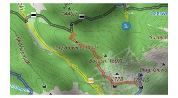
-
Rete di appartenenza. Colora in base all'affiliazione di rete.
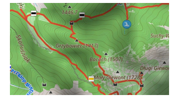
-
Nodo reti. Colora i percorsi in base al tipo di rete di nodi (internazionale, regionale o locale).
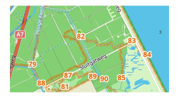
Sentieri per moto da cross
La funzione Sentieri per moto da cross consente di visualizzare sulla mappa percorsi specifici per moto da cross in base al tag dirtbike:scale. Questa scala evidenzia i sentieri adatti alla moto da cross, con una sovrapposizione colorata che mostra i livelli di difficoltà (Legenda della mappa).
Puoi attivare questa funzione in Menu → Configura mappa → Percorsi → Percorsi per moto da cross. Il sistema funziona in modo simile alla scala MTB, offrendo una rappresentazione visiva dei percorsi pensati per la moto da cross — ulteriori informazioni sul tag dirtbike sono disponibili qui.
Percorsi di arrampicata
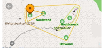
OsmAnd supporta le aree di arrampicata (climbing=area) e i cengioni di arrampicata (climbing=crag), consentendo di trovare le località di arrampicata su roccia direttamente sulla mappa.
-
Aree di arrampicata rappresentano zone più estese in cui esistono più percorsi di arrampicata.
-
Cengioni di arrampicata si riferiscono a formazioni rocciose specifiche o pareti adatte all'arrampicata.
-
Queste località includono attributi dettagliati come:
- Grado di arrampicata (ad es. UIAA, Francese, YDS).
- Tipo di roccia (ad es. calcare, granito).
- Lunghezza del percorso (in metri).
- Qualità dell'arrampicata (solida, friabile, mista).
- Disponibilità del registro di vetta.
Per abilitare le località di arrampicata sulla mappa, vai su: Menu → Configura mappa → Percorsi → Percorsi di arrampicata.
Grado di difficoltà dei sentieri escursionistici
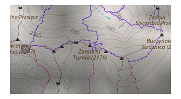
Alcuni segmenti stradali possono far parte di molti percorsi, ma possono essere colorati singolarmente per rappresentare la difficoltà del segmento in zone montane. Attualmente OsmAnd supporta le classificazioni italiana e svizzera, ognuna con un elenco specifico di requisiti di equipaggiamento per accedere al segmento.
Piste e percorsi sciistici
-
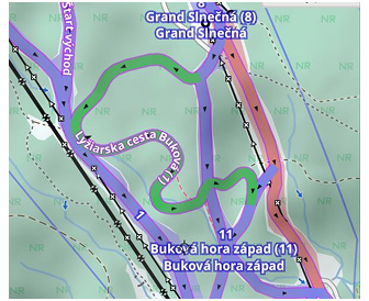
Piste e percorsi sciistici nello stile di mappa Inverno e sci.
-
Piste e percorsi sciistici nello stile di mappa predefinito di OsmAnd.
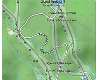
Piste e percorsi sciistici costituiscono un gruppo specifico di percorsi in OpenStreetMap. In genere questi percorsi possono essere utilizzati con lo stile di mappa Inverno e sci con tutte le piste visibili. Se è attivo un altro stile di mappa, viene visualizzato un banner che suggerisce di passare a Inverno e sci (solo Android) e vengono mostrate solo le piste. Tocca Passa per cambiare lo stile della mappa senza uscire dalla schermata corrente, oppure Più tardi per nascondere il banner.
Percorsi per motoslitte
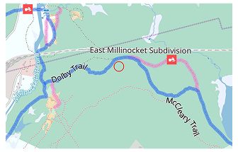
I percorsi per motoslitte sono mappati in OpenStreetMap come route=snowmobile. Vengono utilizzati per il tempo libero invernale e per collegare aree remote durante la stagione della neve. In OsmAnd i percorsi per motoslitte sono cliccabili, vedi la sezione Azioni con i percorsi.
Percorsi a cavallo
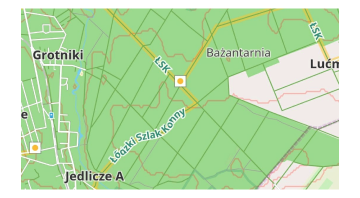
I percorsi a cavallo vengono visualizzati come percorsi indicati con colori e simboli per l'equitazione.
Sport acquatici in acque bianche
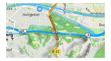
I percorsi in acque bianche vengono mostrati insieme alle icone di accesso, alle aree pericolose e alle rapide vicine per il turismo in acque bianche. Vedi Caratteristiche acque bianche nella Legenda della mappa per i gradi delle rapide, i gradi delle sezioni fluviali e i simboli correlati.
Corsa
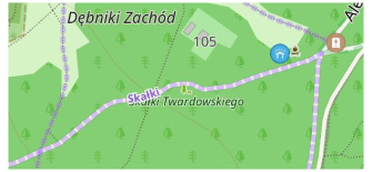
I percorsi di corsa in OpenStreetMap vengono utilizzati per percorsi di corsa nominati, numerati o comunque segnalati, principalmente per l'atletica.
Percorsi fitness
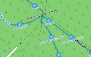
Un percorso fitness è un sentiero o un percorso dotato di ostacoli o stazioni lungo la sua lunghezza per esercitare il corpo umano e migliorare la salute.
Viaggio
This feature is currently not available for the iOS version of the OsmAnd app.
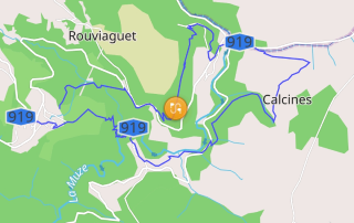
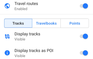
I percorsi di viaggio fanno parte di file personalizzati Guida di viaggio (travel.obf), che possono essere generati dai percorsi dell'utente o far parte di plugin aggiuntivi.
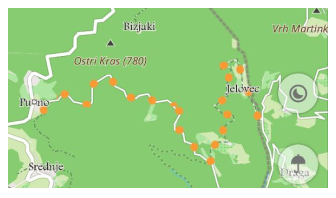
Puoi personalizzare la visualizzazione di determinati Travelbook e tipi di tracce, visualizzare le tracce come punti o Gruppi di punti (ad esempio per le guide di viaggio Wikivoyage). Ulteriori informazioni sulle Guide di viaggio sono disponibili qui.